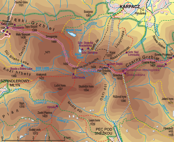
Bestand:Śnieżka.png

Grootte van deze voorvertoning: 735 × 600 pixels. Andere resoluties: 294 × 240 pixels | 588 × 480 pixels | 941 × 768 pixels | 1.255 × 1.024 pixels | 1.390 × 1.134 pixels.
Oorspronkelijk bestand (1.390 × 1.134 pixels, bestandsgrootte: 750 kB, MIME-type: image/png)
Bestandsgeschiedenis
Klik op een datum/tijd om het bestand te zien zoals het destijds was.
| Datum/tijd | Miniatuur | Afmetingen | Gebruiker | Opmerking | |
|---|---|---|---|---|---|
| huidige versie | 17 okt 2009 19:24 |  | 1.390 × 1.134 (750 kB) | Aotearoa | drobne poprawki |
| 14 aug 2008 07:39 |  | 1.396 × 1.141 (973 kB) | Aotearoa | {{Information |Description= |Source= |Date= |Author= |Permission= |other_versions= }} | |
| 13 aug 2008 12:31 |  | 1.397 × 1.142 (799 kB) | Aotearoa | {{Information |Description={{en|1=Map of Mt. Śnieżka and neighbourhood}} {{pl|1=Mapa Śnieżki i okolic}} |Source=Praca własna osoby przesyłającej (own work by uploader) |Author=Aotearoa |Date=13.08.2008 |Permission= |other_versions |
Bestandsgebruik
Dit bestand wordt op de volgende 2 pagina's gebruikt:
Globaal bestandsgebruik
De volgende andere wiki's gebruiken dit bestand:
- Gebruikt op ca.wiki.x.io
- Gebruikt op cs.wiki.x.io
- Gebruikt op da.wiki.x.io
- Gebruikt op de.wiki.x.io
- Gebruikt op en.wiki.x.io
- Gebruikt op hu.wiki.x.io
- Gebruikt op pl.wiki.x.io
- Schronisko PTTK „Samotnia”
- Schronisko PTTK „Strzecha Akademicka”
- Droga Przyjaźni Polsko-Czeskiej
- Wikipedysta:Aotearoa/brudnopis
- Łomniczka (potok)
- Równia pod Śnieżką
- Mały Staw (jezioro w Karkonoszach)
- Kocioł Łomniczki
- Biały Jar
- Przełęcz pod Śnieżką
- Złotówka (Karkonosze)
- Mapa turystyczna
- Úpa
- Wikipedysta:Aotearoa/mapy
- Kompleks Narciarski Kopa w Karpaczu
- Gebruikt op ro.wiki.x.io
- Gebruikt op ru.wiki.x.io
- Gebruikt op si.wiki.x.io
- Gebruikt op uz.wiki.x.io
- Gebruikt op vi.wiki.x.io
- Gebruikt op www.wikidata.org

