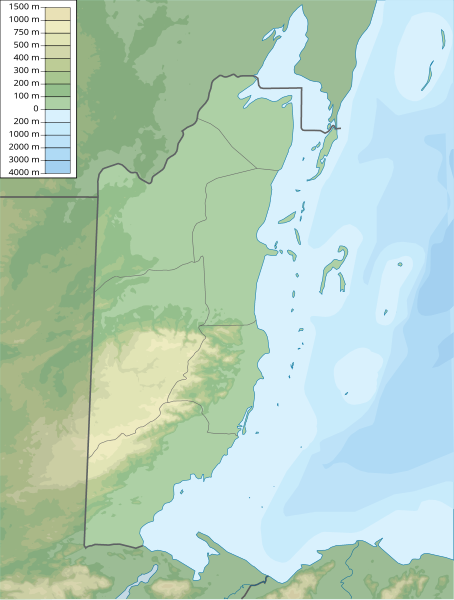
Bestand:Belize physical map.svg

Afmetingen van deze voorvertoning van het type PNG van dit SVG-bestand: 454 × 599 pixels Andere resoluties: 182 × 240 pixels | 364 × 480 pixels | 582 × 768 pixels | 776 × 1.024 pixels | 1.552 × 2.048 pixels | 851 × 1.123 pixels.
Oorspronkelijk bestand (SVG-bestand, nominaal 851 × 1.123 pixels, bestandsgrootte: 575 kB)
Bestandsgeschiedenis
Klik op een datum/tijd om het bestand te zien zoals het destijds was.
| Datum/tijd | Miniatuur | Afmetingen | Gebruiker | Opmerking | |
|---|---|---|---|---|---|
| huidige versie | 24 jan 2018 01:28 |  | 851 × 1.123 (575 kB) | Kaldari | Fixing border between Belize and Mexico in Ambergris Caye. Also removing partial maritime border line. |
| 10 mrt 2011 18:16 |  | 851 × 1.123 (569 kB) | Urutseg |
Bestandsgebruik
Dit bestand wordt op de volgende 5 pagina's gebruikt:
Globaal bestandsgebruik
De volgende andere wiki's gebruiken dit bestand:
- Gebruikt op ar.wiki.x.io
- Gebruikt op ast.wiki.x.io
- Gebruikt op az.wiki.x.io
- Gebruikt op ba.wiki.x.io
- Gebruikt op be-tarask.wiki.x.io
- Gebruikt op be.wiki.x.io
- Gebruikt op bg.wiki.x.io
- Gebruikt op bn.wiki.x.io
- Gebruikt op bs.wiki.x.io
- Gebruikt op ceb.wiki.x.io
- Gebruikt op ckb.wiki.x.io
- Gebruikt op cs.wiki.x.io
- Gebruikt op da.wiki.x.io
- Gebruikt op de.wiki.x.io
- Belize
- Caye Caulker
- Ambergris Caye
- Maya Mountains
- Victoria Peak (Belize)
- Vorlage:Positionskarte Belize
- Doyle’s Delight
- Wikipedia:Kartenwerkstatt/Positionskarten/Nordamerika
- Turneffe
- Blackadore Caye
- Caye Chapel
- Cayo Espanto
- Goff’s Caye
- Half Moon Caye
- St. George’s Caye
- Laughing Bird Caye
- Moho Caye
- Long Caye
- Lighthouse Reef
- Aguacate Lagoon
- Honey Camp Lagoon
- Benutzer:Shi Annan/Cockscomb Basin Wildlife Sanctuary
- Twin Cays
- Sandbore Caye
- Harvest Caye
- Tobacco Caye
- Royal Belize
Globaal gebruik van dit bestand bekijken.