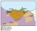
Bestand:Carte des tribus du Rif.PNG
Carte_des_tribus_du_Rif.PNG (407 × 347 pixels, bestandsgrootte: 15 kB, MIME-type: image/png)
Bestandsgeschiedenis
Klik op een datum/tijd om het bestand te zien zoals het destijds was.
| Datum/tijd | Miniatuur | Afmetingen | Gebruiker | Opmerking | |
|---|---|---|---|---|---|
| huidige versie | 12 apr 2020 19:39 |  | 407 × 347 (15 kB) | Omar-toons | Adjust Targuist, Aït Gmil, Aït Boufrah & Aït Itteft partly Berber-speaking areas acc. to Lafkioui |
| 22 jun 2016 18:03 |  | 407 × 347 (15 kB) | Omar-toons | Corr. Srayr & Triffa | |
| 6 mei 2015 07:08 |  | 407 × 347 (15 kB) | Omar-toons | min. ch. on Sanhaja d-Srayr acc. to Lafkioui: Berberophones remain among Ketamas, Riffian for N.E. Mezdouy | |
| 2 apr 2015 04:13 |  | 407 × 347 (15 kB) | Omar-toons | min. ch. | |
| 24 mrt 2015 07:48 |  | 407 × 347 (15 kB) | Omar-toons | corr. numérotation | |
| 24 mrt 2015 07:18 |  | 407 × 347 (15 kB) | Omar-toons | User created page with UploadWizard |
Bestandsgebruik
Dit bestand wordt op de volgende 12 pagina's gebruikt:
Globaal bestandsgebruik
De volgende andere wiki's gebruiken dit bestand:
- Gebruikt op ca.wiki.x.io
- Gebruikt op de.wiki.x.io
- Gebruikt op en.wiki.x.io
- Gebruikt op es.wiki.x.io
- Gebruikt op eu.wiki.x.io
- Gebruikt op fr.wiki.x.io
- Gebruikt op pt.wiki.x.io