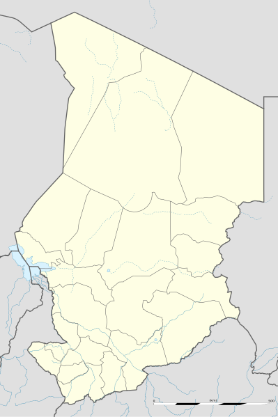
Bestand:Chad location map.svg

Afmetingen van deze voorvertoning van het type PNG van dit SVG-bestand: 399 × 599 pixels Andere resoluties: 160 × 240 pixels | 320 × 480 pixels | 512 × 768 pixels | 682 × 1.024 pixels | 1.365 × 2.048 pixels | 899 × 1.349 pixels.
Oorspronkelijk bestand (SVG-bestand, nominaal 899 × 1.349 pixels, bestandsgrootte: 294 kB)
Bestandsgeschiedenis
Klik op een datum/tijd om het bestand te zien zoals het destijds was.
| Datum/tijd | Miniatuur | Afmetingen | Gebruiker | Opmerking | |
|---|---|---|---|---|---|
| huidige versie | 14 jul 2011 23:26 |  | 899 × 1.349 (294 kB) | Sting | Sudan/South Sudan 2011-07 border update |
| 24 nov 2009 00:28 |  | 899 × 1.349 (268 kB) | Sting | == {{int:filedesc}} == {{Location|15|27|00|N|18|43|30|E|scale:7000000}} <br/> {{Information |Description={{en|Blank administrative map of Chad as after the 2008-02 reform of the Regions, for geo-location purposes.}} {{fr|Carte administrative |
Bestandsgebruik
Dit bestand wordt op de volgende 30 pagina's gebruikt:
- Abéché
- Adré
- Am Timan
- Ati (stad)
- Bardaï
- Biltine
- Bol (Tsjaad)
- Bongor
- Borota (Tsjaad)
- CEMAC Cup 2007
- Doba (Tsjaad)
- Faya-Largeau
- Goré
- Koumra
- Laï
- Luchthaven Adré
- Mao (Tsjaad)
- Massakory
- Massenya
- Mongo (Tsjaad)
- Moundou
- Ndjamena
- Ouara
- Ounianga Kébir
- Pala (Tsjaad)
- Sarh
- Stade Omnisports Idriss Mahamat Ouya
- Zouar
- Wikipedia:Humor en Onzin/Nvidia (stad)
- Sjabloon:Positiekaart Tsjaad
Globaal bestandsgebruik
De volgende andere wiki's gebruiken dit bestand:
- Gebruikt op af.wiki.x.io
- Gebruikt op am.wiki.x.io
- Gebruikt op ar.wiki.x.io
- Gebruikt op az.wiki.x.io
- Gebruikt op ba.wiki.x.io
- Gebruikt op be-tarask.wiki.x.io
- Gebruikt op be.wiki.x.io
- Gebruikt op bg.wiki.x.io
- Gebruikt op bn.wiki.x.io
- Gebruikt op bs.wiki.x.io
- Gebruikt op ceb.wiki.x.io
Globaal gebruik van dit bestand bekijken.

