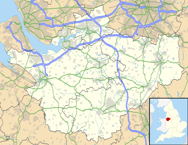
Bestand:Cheshire UK location map.svg

Afmetingen van deze voorvertoning van het type PNG van dit SVG-bestand: 778 × 599 pixels Andere resoluties: 312 × 240 pixels | 623 × 480 pixels | 997 × 768 pixels | 1.280 × 986 pixels | 2.560 × 1.973 pixels | 1.425 × 1.098 pixels.
Oorspronkelijk bestand (SVG-bestand, nominaal 1.425 × 1.098 pixels, bestandsgrootte: 2,23 MB)
Bestandsgeschiedenis
Klik op een datum/tijd om het bestand te zien zoals het destijds was.
| Datum/tijd | Miniatuur | Afmetingen | Gebruiker | Opmerking | |
|---|---|---|---|---|---|
| huidige versie | 26 sep 2010 19:42 |  | 1.425 × 1.098 (2,23 MB) | Nilfanion | {{Information |Description=Map of Cheshire, UK with the following information shown: *Administrative borders *Coastline, lakes and rivers *Roads and railways *Urban areas Equirectangular map projection on WGS 84 datum, with N/S stretched 1 |
Bestandsgebruik
Meer dan 100 pagina's gebruiken dit bestand. De volgende lijst geeft alleen de eerste 100 pagina's weer die dit bestand gebruiken. Er is ook een volledige lijst beschikbaar.
- Adlington (Cheshire)
- Agden
- Alderley Edge
- Aldersey
- Aldford
- Alsager
- Arclid
- Ashton Hayes
- Audlem
- Bache (civil parish)
- Backford
- Barnton
- Barthomley
- Betchton
- Bewsey
- Birchwood (Warrington)
- Bollington
- Bosley
- Bradwall
- Brereton
- Brindley
- Bunbury (Engeland)
- Caldecott (Cheshire)
- Capenhurst
- Caughall
- Chelford
- Chester (Verenigd Koninkrijk)
- Chidlow
- Cholmondeley
- Chorlton
- Chorlton by Backford
- Chowley
- Christleton
- Church Lawton
- Church Minshull
- Church Shocklach
- Churton Heath
- Churton by Aldford
- Churton by Farndon
- Clotton Hoofield
- Congleton (plaats)
- Cotton Abbotts
- Cotton Edmunds
- Cranage
- Crewe
- Crewe Green
- Crewe by Farndon
- Daresbury
- Davenham
- Disley
- Dodleston
- Duddon
- Eccleston (Cheshire)
- Ellesmere Port
- Farndon
- Frodsham
- Golborne Bellow
- Golborne David
- Goostrey
- Great Budworth
- Great Sankey
- Great Warford
- Guilden Sutton
- Hankelow
- Hapsford
- Haslington
- Hassall
- Helsby
- Henbury (Cheshire)
- High Legh
- Hockenhull
- Holmes Chapel
- Horton by Malpas
- Horton cum Peel
- Hulme Walfield
- Iddinshall
- Ince
- Kelsall
- Kettleshulme
- Kings Marsh
- Knutsford
- Larkton
- Latchford
- Lea-by-Backford
- Lea Newbold
- Little Bollington
- Little Stanney
- Lostock Gralam
- Lower Kinnerton
- Lyme Handley
- Lymm
- Macclesfield (Engeland)
- Marbury
- Marlston cum Lache
- Marthall
- Runcorn
- Stockton Heath
- Thelwall
- Warrington (Engeland)
- Westy
Meer koppelingen naar dit bestand bekijken.
Globaal bestandsgebruik
De volgende andere wiki's gebruiken dit bestand:
- Gebruikt op ar.wiki.x.io
- Gebruikt op arz.wiki.x.io
- Gebruikt op bg.wiki.x.io
- Gebruikt op bn.wiki.x.io
- Gebruikt op ca.wiki.x.io
- Gebruikt op ceb.wiki.x.io
- Gebruikt op diq.wiki.x.io
- Gebruikt op el.wiki.x.io
- Gebruikt op en.wiki.x.io
- Cheshire
- Peckforton Castle
- Aldford
- Bunbury, Cheshire
- Chester
- Audlem
- Beeston, Cheshire
- Bollington
- Chester Castle
- Congleton
- Disley
- Lyme Park
- Farndon, Cheshire
- Frodsham
- Gawsworth
- Gawsworth Old Hall
- Great Budworth
- Marston, Cheshire
- Knutsford
- Langley, Cheshire
- Crewe
- Kelsall
- Nantwich
- Runcorn
- Latchford, Cheshire
- Macclesfield
- Woolston, Cheshire
- Daresbury
- Great Sankey
- Winwick, Cheshire
- Penketh
- Ellesmere Port
- Neston
- Croft, Cheshire
- Alsager
- Northwich
- Tattenhall
- Lymm
- Padgate
- Birchwood, Cheshire
Globaal gebruik van dit bestand bekijken.