Bestand:Danske-amter-1793-1970.png
Danske-amter-1793-1970.png (400 × 479 pixels, bestandsgrootte: 11 kB, MIME-type: image/png)
Bestandsgeschiedenis
Klik op een datum/tijd om het bestand te zien zoals het destijds was.
| Datum/tijd | Miniatuur | Afmetingen | Gebruiker | Opmerking | |
|---|---|---|---|---|---|
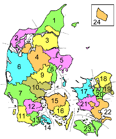
| huidige versie | 28 jul 2005 15:41 |  | 400 × 479 (11 kB) | Lars Helbo~commonswiki | This is a map showing Danish counties as they were during the period 1793-1970. The map was drawn by Lars Helbo {{PD}} |
Bestandsgebruik
Dit bestand wordt op de volgende pagina gebruikt:
Globaal bestandsgebruik
De volgende andere wiki's gebruiken dit bestand:
- Gebruikt op da.wiki.x.io
- Gebruikt op de.wiki.x.io
- Gebruikt op en.wiki.x.io
- Gebruikt op fi.wiki.x.io
- Gebruikt op ko.wiki.x.io
- Gebruikt op no.wiki.x.io
- Gebruikt op sv.wiki.x.io
