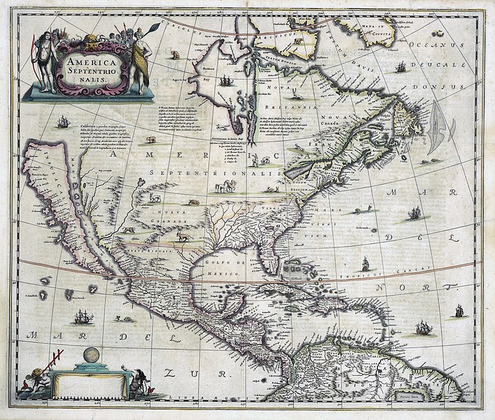
Bestand:Hondius-Jansson America Septentrionalis 1636 UTA.jpg

Grootte van deze voorvertoning: 706 × 599 pixels. Andere resoluties: 283 × 240 pixels | 565 × 480 pixels | 905 × 768 pixels | 1.206 × 1.024 pixels | 2.412 × 2.048 pixels | 6.814 × 5.786 pixels.
Oorspronkelijk bestand (6.814 × 5.786 pixels, bestandsgrootte: 18,94 MB, MIME-type: image/jpeg)
Bestandsgeschiedenis
Klik op een datum/tijd om het bestand te zien zoals het destijds was.
| Datum/tijd | Miniatuur | Afmetingen | Gebruiker | Opmerking | |
|---|---|---|---|---|---|
| huidige versie | 3 feb 2022 01:42 |  | 6.814 × 5.786 (18,94 MB) | Michael Barera | == {{int:filedesc}} == {{Map |title = {{la|'''''America Septentrionalis'''''}} |description = {{en|This famous Dutch map exhibits the general state of European knowledge (and ignorance) about North America at the time of its first publication in 1636. Much of the hard earned knowledge came from danger filled explorations funded by various chartered companies. The map shows Hudson's Bay, reflecting knowledge of the results of Hudson's last fatal voyage of 1610 under the aus... |
Bestandsgebruik
Dit bestand wordt op de volgende 2 pagina's gebruikt:
Globaal bestandsgebruik
De volgende andere wiki's gebruiken dit bestand:
- Gebruikt op ca.wiki.x.io
- Gebruikt op de.wiki.x.io
- Gebruikt op en.wiki.x.io
- Gebruikt op fy.wiki.x.io
- Gebruikt op ja.wiki.x.io
- Gebruikt op ru.wiki.x.io

