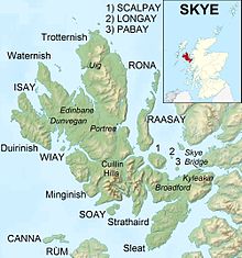
Bestand:Isle of Skye UK relief location map.jpg

Grootte van deze voorvertoning: 562 × 599 pixels. Andere resoluties: 225 × 240 pixels | 450 × 480 pixels | 720 × 768 pixels | 960 × 1.024 pixels | 2.004 × 2.137 pixels.
Oorspronkelijk bestand (2.004 × 2.137 pixels, bestandsgrootte: 462 kB, MIME-type: image/jpeg)
Bestandsgeschiedenis
Klik op een datum/tijd om het bestand te zien zoals het destijds was.
| Datum/tijd | Miniatuur | Afmetingen | Gebruiker | Opmerking | |
|---|---|---|---|---|---|
| huidige versie | 17 dec 2011 01:28 |  | 2.004 × 2.137 (462 kB) | Nilfanion | {{Information |Description=Relief map of the Isle of Skye, UK. Equirectangular map projection on WGS 84 datum, with N/S stretched 180% Geographic limits: *West: 6.85W *East: 5.5W *North: 57.8N *South: 57.0N |Source=[[w:Ordnance Survey |
Bestandsgebruik
Dit bestand wordt op de volgende 44 pagina's gebruikt:
- Allt a' Bhàthaich
- Am Bord
- Arnaval
- Beinn Bhuidhe
- Beinn Buidhe na Creige
- Beinn na Caillich
- Biod Ruadh
- Castle Moil
- Cnoc na H-Eighich
- Cnoc na h-lolaire
- Cnoc nan Speireag
- Creag Omain
- Dun Beag
- Duntulm Castle
- Dunvegan Castle
- Eas Mòr
- Eynort River
- Fladda-chùain
- Gaeilavore
- Gearran
- Glamaig
- Huisgill Burn
- Leachd a' Leinibh
- Loch Cill Chriosd
- Loch Eynort
- Loch Fada
- Loch Lic-àird
- Loch Scavaig
- Loch a' Ghille-chnapain
- Loch nan Uan
- Preshal More
- Preshal beg
- Raasay
- Rona
- Scalpay (Binnen-Hebriden)
- Sgùrr an Fheòir
- Sgùrr nan Gillean
- Sleadale Burn
- Stac a' Mheadais
- Stockval
- Talisker (rivier)
- Talisker Bay
- Trodday
- Sjabloon:Positiekaart Skye
Globaal bestandsgebruik
De volgende andere wiki's gebruiken dit bestand:
- Gebruikt op ar.wiki.x.io
- Gebruikt op ceb.wiki.x.io
- Gebruikt op cs.wiki.x.io
- Gebruikt op da.wiki.x.io
- Gebruikt op de.wiki.x.io
- Gebruikt op en.wiki.x.io
- Soay, Inner Hebrides
- Sorley MacLean
- Raasay
- South Rona
- Scalpay, Inner Hebrides
- Sgùrr Alasdair
- Blà Bheinn
- Wiay, Inner Hebrides
- Eilean Bàn
- Am Basteir
- Bruach na Frìthe
- Sgùrr a' Ghreadaidh
- Sgùrr a' Mhadaidh
- Pabay
- Ornsay
- Beinn na Caillich (Red Hills)
- Eilean Mòr, Crowlin Islands
- Loch Snizort
- Isle of Skye
- South Ascrib
- Harlosh Island
- Tarner Island
- Eilean Tigh
- Eilean Mòr, Loch Dunvegan
- Staffin Island
- Module:Location map/data/Scotland Isle of Skye/doc
- Beinn na Caillich (Kyle Rhea)
- Eilean Meadhonach
- High Pasture Cave
- Portal:Islands/Selected article
- Module:Location map/data/Scotland Isle of Skye
Globaal gebruik van dit bestand bekijken.
