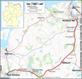
Bestand:Karte Bahnstrecke Bad Kleinen-Rostock.png

Grootte van deze voorvertoning: 623 × 600 pixels. Andere resoluties: 249 × 240 pixels | 498 × 480 pixels | 797 × 768 pixels | 1.063 × 1.024 pixels | 1.542 × 1.485 pixels.
Oorspronkelijk bestand (1.542 × 1.485 pixels, bestandsgrootte: 1.007 kB, MIME-type: image/png)
Bestandsgeschiedenis
Klik op een datum/tijd om het bestand te zien zoals het destijds was.
| Datum/tijd | Miniatuur | Afmetingen | Gebruiker | Opmerking | |
|---|---|---|---|---|---|
| huidige versie | 1 jun 2015 19:13 |  | 1.542 × 1.485 (1.007 kB) | Cmdrjameson | Compressed with pngout. Reduced by 406kB (28% decrease). |
| 30 aug 2010 22:30 |  | 1.542 × 1.485 (1,38 MB) | Muns | +Bäderbahn "Molli", Friedrichswalde | |
| 29 aug 2010 23:48 |  | 1.542 × 1.485 (1,37 MB) | Muns | vgl. Diskussion in der Kartenwerkstatt: Friedrich-Franz-Bahnhof, Farben Bahn/Straße, weiterführende Strecken, Kleinkram | |
| 16 aug 2010 22:36 |  | 1.553 × 1.485 (1,38 MB) | Muns | {{Information |Description={{en|1=Railway Map Germany: Bad Kleinen - Rostock}} {{de|1=Eisenbahnstrecke Bad Kleinen - Rostock}} |Source={{de|Eigene Arbeit, nutzt}} {{en|Own work, uses}} *File:Germany location map.svg, by [[User:NordNordWest|NordNordWe |
Bestandsgebruik
Dit bestand wordt op de volgende pagina gebruikt:
Globaal bestandsgebruik
De volgende andere wiki's gebruiken dit bestand:
- Gebruikt op de.wiki.x.io
- Gebruikt op en.wiki.x.io
- Gebruikt op pl.wiki.x.io
- Gebruikt op www.wikidata.org
