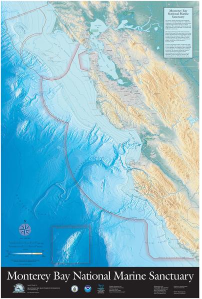
Bestand:MBNMS Davidson Map Update.pdf

Afmetingen van deze voorvertoning van het type JPG van dit PDF-bestand: 404 × 599 pixels Andere resoluties: 162 × 240 pixels | 324 × 480 pixels | 518 × 768 pixels | 690 × 1.024 pixels | 1.381 × 2.048 pixels | 3.664 × 5.433 pixels.
Oorspronkelijk bestand (3.664 × 5.433 pixels, bestandsgrootte: 3,73 MB, MIME-type: application/pdf)
Bestandsgeschiedenis
Klik op een datum/tijd om het bestand te zien zoals het destijds was.
| Datum/tijd | Miniatuur | Afmetingen | Gebruiker | Opmerking | |
|---|---|---|---|---|---|
| huidige versie | 22 jan 2010 01:14 |  | 3.664 × 5.433 (3,73 MB) | Sophie.debeukelaer | {{Information |Description={{en|1=Three sanctuaries- Monterey Bay, Gulf of the Farallones, and Cordell Bank0 are found along California's central Coast. The largest and deepest of the marine sanctuaries, Monterey Bay, spans 6094 square miles of wave-swep |
Bestandsgebruik
Dit bestand wordt op de volgende pagina gebruikt:
Globaal bestandsgebruik
De volgende andere wiki's gebruiken dit bestand:
- Gebruikt op ca.wiki.x.io
- Gebruikt op de.wiki.x.io
- Gebruikt op en.wiki.x.io
- Gebruikt op es.wiki.x.io
- Gebruikt op fr.wiki.x.io
- Gebruikt op hu.wiki.x.io
