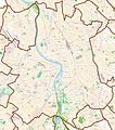
Bestand:Map Toulouse.jpg

Grootte van deze voorvertoning: 528 × 600 pixels. Andere resoluties: 211 × 240 pixels | 422 × 480 pixels | 676 × 768 pixels | 901 × 1.024 pixels | 1.865 × 2.119 pixels.
Oorspronkelijk bestand (1.865 × 2.119 pixels, bestandsgrootte: 4,59 MB, MIME-type: image/jpeg)
Bestandsgeschiedenis
Klik op een datum/tijd om het bestand te zien zoals het destijds was.
| Datum/tijd | Miniatuur | Afmetingen | Gebruiker | Opmerking | |
|---|---|---|---|---|---|
| huidige versie | 23 okt 2011 19:50 |  | 1.865 × 2.119 (4,59 MB) | XIIIfromTOKYO | {{Information |Description ={{en|1=Map of Toulouse, France}} {{fr|1=Carte de Toulouse, France}} |Source ={{openstreetmap}} |Author =OpenStreetMap contributors |Date =2011-10-23 |Permission = |other_versions = }} [[Categor |
Bestandsgebruik
Dit bestand wordt op de volgende 11 pagina's gebruikt:
Globaal bestandsgebruik
De volgende andere wiki's gebruiken dit bestand:
- Gebruikt op ar.wiki.x.io
- Gebruikt op ba.wiki.x.io
- Gebruikt op ca.wiki.x.io
- Gebruikt op ceb.wiki.x.io
- Gebruikt op da.wiki.x.io
- Gebruikt op en.wiki.x.io
- Gebruikt op eo.wiki.x.io
- Tuluzo
- Naturhistoria Muzeo de Tuluzo
- École nationale de l'aviation civile
- Universitato de Tuluzo
- Muzeo de la Aŭgustenanoj
- Domo de Okcitanio
- Kapitolo de Tuluzo
- Ponto de la katalunoj
- Hôtel d'Assézat
- Teatro de la Kapitolo
- Halle aux Grains
- Les Abattoirs
- Apudgarona Kanalo
- Toulouse Business School
- Stadiono Municipa de Tuluzo
- Toulouse-Matabiau (stacidomo)
- Le Toec (stacidomo)
- Saint-Agne (stacidomo)
- Lardenne (stacidomo)
- Les Ramassiers (stacidomo)
- Saint-Cyprien-Arènes (stacidomo)
- Saint-Martin-du-Touch (stacidomo)
- Gallieni-Cancéropôle (stacidomo)
- Ŝablono:Situo sur mapo Francio Tuluzo
- Lalande-Église (stacidomo)
- Montaudran (stacidomo)
- Route-de-Launaguet (stacidomo)
- Lacourtensourt (stacidomo)
- Empalot (stacidomo)
- Lycée Pierre-de-Fermat
- Gebruikt op es.wiki.x.io
Globaal gebruik van dit bestand bekijken.