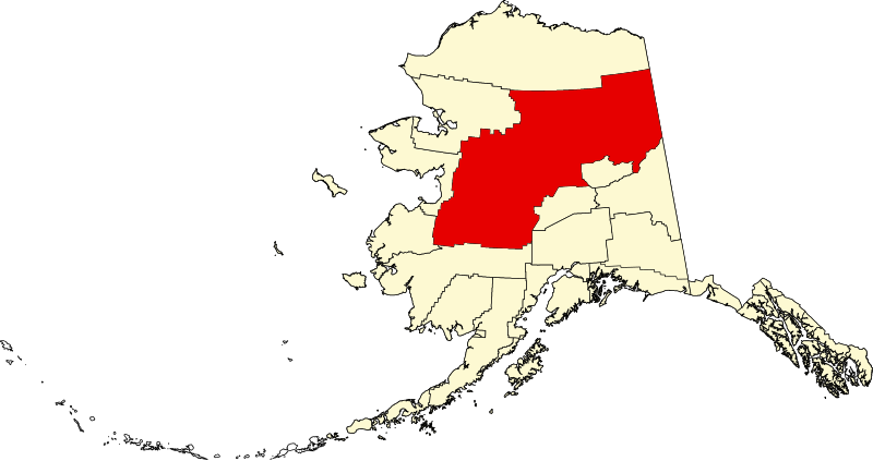
Bestand:Map of Alaska highlighting Yukon-Koyukuk Census Area.svg

Afmetingen van deze voorvertoning van het type PNG van dit SVG-bestand: 800 × 423 pixels Andere resoluties: 320 × 169 pixels | 640 × 338 pixels | 1.024 × 541 pixels | 1.280 × 677 pixels | 2.560 × 1.353 pixels | 1.470 × 777 pixels.
Oorspronkelijk bestand (SVG-bestand, nominaal 1.470 × 777 pixels, bestandsgrootte: 644 kB)
Bestandsgeschiedenis
Klik op een datum/tijd om het bestand te zien zoals het destijds was.
| Datum/tijd | Miniatuur | Afmetingen | Gebruiker | Opmerking | |
|---|---|---|---|---|---|
| huidige versie | 25 jun 2024 21:13 |  | 1.470 × 777 (644 kB) | Nux | uniform colors with good contrast |
| 18 jun 2024 00:00 |  | 1.470 × 777 (338 kB) | Nux | fix rendering (remove clipping) | |
| 5 mrt 2006 20:30 |  | 1.470 × 777 (338 kB) | David Benbennick | {{subst:User:Dbenbenn/clm|county=Yukon-Koyukuk Census Area|state=Alaska|type=borough and census area}} |
Bestandsgebruik
Dit bestand wordt op de volgende pagina gebruikt:
Globaal bestandsgebruik
De volgende andere wiki's gebruiken dit bestand:
- Gebruikt op av.wiki.x.io
- Gebruikt op bpy.wiki.x.io
- Gebruikt op ca.wiki.x.io
- Tanana (Alaska)
- Huslia
- Central (Alaska)
- Alatna
- Allakaket
- Anvik
- Arctic Village
- Beaver (Alaska)
- Bettles
- Birch Creek
- Chalkyitsik
- Circle (Alaska)
- Coldfoot
- Evansville (Alaska)
- Fort Yukon
- Four Mile Road
- Galena (Alaska)
- Grayling (Alaska)
- Holy Cross (Alaska)
- Hughes (Alaska)
- Kaltag
- Koyukuk
- Lake Minchumina
- Livengood
- Manley Hot Springs
- Minto (Alaska)
- Nenana
- New Allakaket
- Nikolai (Alaska)
- Nulato
- Rampart
- Ruby (Alaska)
- Shageluk
- Stevens Village
- Takotna
- Venetie (Alaska)
- Wiseman
- Plantilla:Àrea censal de Yukon-Koyukuk
- Categoria:Àrea censal de Yukon-Koyukuk
- Llista de boroughs i àrees censals d'Alaska
- Gebruikt op ce.wiki.x.io
- Gebruikt op de.wiki.x.io
Globaal gebruik van dit bestand bekijken.