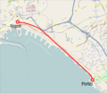
Bestand:Mappa Napoli-Portici.png

Grootte van deze voorvertoning: 691 × 600 pixels. Andere resoluties: 277 × 240 pixels | 553 × 480 pixels | 885 × 768 pixels | 1.024 × 889 pixels.
Oorspronkelijk bestand (1.024 × 889 pixels, bestandsgrootte: 782 kB, MIME-type: image/png)
Bestandsgeschiedenis
Klik op een datum/tijd om het bestand te zien zoals het destijds was.
| Datum/tijd | Miniatuur | Afmetingen | Gebruiker | Opmerking | |
|---|---|---|---|---|---|
| huidige versie | 20 mei 2010 23:27 |  | 1.024 × 889 (782 kB) | Arbalete | {{Information |Description={{it|1=Mappa della ferrovia Napoli-Portici all'epoca dell'inaugurazione (1839)}} |Source={{own}} |Author=Friedrichstrasse |Date=maggio 2010 |Permission= |other_versions= }} [[Category:Rail transport ma |
Bestandsgebruik
Dit bestand wordt op de volgende pagina gebruikt:
Globaal bestandsgebruik
De volgende andere wiki's gebruiken dit bestand:
- Gebruikt op de.wiki.x.io
- Gebruikt op en.wiki.x.io
- Gebruikt op es.wiki.x.io
- Gebruikt op fr.wiki.x.io
- Gebruikt op hu.wiki.x.io
- Gebruikt op it.wiki.x.io
- Gebruikt op lmo.wiki.x.io
- Gebruikt op nap.wiki.x.io
- Gebruikt op www.wikidata.org
