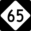
Bestand:NC 65.svg

Afmetingen van deze voorvertoning van het type PNG van dit SVG-bestand: 600 × 600 pixels Andere resoluties: 240 × 240 pixels | 480 × 480 pixels | 768 × 768 pixels | 1.024 × 1.024 pixels | 2.048 × 2.048 pixels.
Oorspronkelijk bestand (SVG-bestand, nominaal 600 × 600 pixels, bestandsgrootte: 5 kB)
Bestandsgeschiedenis
Klik op een datum/tijd om het bestand te zien zoals het destijds was.
| Datum/tijd | Miniatuur | Afmetingen | Gebruiker | Opmerking | |
|---|---|---|---|---|---|
| huidige versie | 14 sep 2006 21:44 |  | 600 × 600 (5 kB) | TwinsMetsFan | {{Information |Description=600 mm by 600 mm (24 in by 24 in) North Carolina highway shield, made to the specifications of the Manual on Uniform Traffic Control Devices (MUTCD), 2003 Edition (sign M1-5). Uses the Roadgeek 2005 fonts. (United States law doe |
Bestandsgebruik
Dit bestand wordt op de volgende pagina gebruikt:
Globaal bestandsgebruik
De volgende andere wiki's gebruiken dit bestand:
- Gebruikt op en.wiki.x.io
- Stokes County, North Carolina
- Rockingham County, North Carolina
- Guilford County, North Carolina
- Forsyth County, North Carolina
- U.S. Route 311
- U.S. Route 158
- U.S. Route 64 in North Carolina
- North Carolina Highway 8
- North Carolina Highway 87
- Winston-Salem Northern Beltway
- List of highways numbered 65
- Interstate 74 in North Carolina
- Wikipedia:WikiProject U.S. Roads/Redirects/North Carolina/1-99
- Interstate 73 in North Carolina
- North Carolina Highway 68
- U.S. Route 220 in North Carolina
- U.S. Route 52 in North Carolina
- North Carolina Highway 65
- North Carolina Highway 66
- North Carolina Highway 704
- List of state highways in North Carolina
- Gebruikt op es.wiki.x.io
- Gebruikt op fr.wiki.x.io
- Gebruikt op ja.wiki.x.io
- Gebruikt op ru.wiki.x.io
- Gebruikt op zh-min-nan.wiki.x.io
