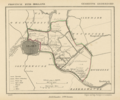
Bestand:Netherlands, Leiderdorp, map of 1867.png

Grootte van deze voorvertoning: 717 × 600 pixels. Andere resoluties: 287 × 240 pixels | 574 × 480 pixels | 918 × 768 pixels | 1.224 × 1.024 pixels | 2.448 × 2.048 pixels.
Oorspronkelijk bestand (2.448 × 2.048 pixels, bestandsgrootte: 7,52 MB, MIME-type: image/png)
Bestandsgeschiedenis
Klik op een datum/tijd om het bestand te zien zoals het destijds was.
| Datum/tijd | Miniatuur | Afmetingen | Gebruiker | Opmerking | |
|---|---|---|---|---|---|
| huidige versie | 23 nov 2011 21:33 |  | 2.448 × 2.048 (7,52 MB) | Loranchet | {{Information |Description ={{nl|1=Kaart uit 1867 van de gemeente Leiderdorp (Prov. Zuid-Holland). Leiderdorp bestaat nog steeds als een onafhankelijke gemeente (2011).}} {{en|1=Map of 1867 of the municipality of Leiderdorp (close to the town of Leiden |
Bestandsgebruik
Dit bestand wordt op de volgende 4 pagina's gebruikt:
Globaal bestandsgebruik
De volgende andere wiki's gebruiken dit bestand:
- Gebruikt op ar.wiki.x.io
- Gebruikt op en.wiki.x.io
- Gebruikt op es.wiki.x.io
- Gebruikt op fa.wiki.x.io
- Gebruikt op id.wiki.x.io
- Gebruikt op ja.wiki.x.io
- Gebruikt op www.wikidata.org