Bestand:Nihoa map lrg.gif
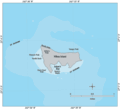
Nihoa_map_lrg.gif (600 × 545 pixels, bestandsgrootte: 14 kB, MIME-type: image/gif)
Bestandsgeschiedenis
Klik op een datum/tijd om het bestand te zien zoals het destijds was.
| Datum/tijd | Miniatuur | Afmetingen | Gebruiker | Opmerking | |
|---|---|---|---|---|---|
| huidige versie | 12 apr 2007 11:56 |  | 600 × 545 (14 kB) | Telim tor | == Information == {{Information |Description=25px Bathymetric map of Nihoa Island, Northwestern Hawaiian Islands 25px Bathymetrische Karte der Insel Nihoa, Nordwestliche Hawaii-Insel |
Bestandsgebruik
Dit bestand wordt op de volgende pagina gebruikt:
Globaal bestandsgebruik
De volgende andere wiki's gebruiken dit bestand:
- Gebruikt op ceb.wiki.x.io
- Gebruikt op de.wiki.x.io
- Gebruikt op en.wiki.x.io
- Gebruikt op eo.wiki.x.io
- Gebruikt op es.wiki.x.io
- Gebruikt op fi.wiki.x.io
- Gebruikt op frr.wiki.x.io
- Gebruikt op pt.wiki.x.io
- Gebruikt op ru.wiki.x.io

