Oorspronkelijk bestand (1.105 × 500 pixels, bestandsgrootte: 450 kB, MIME-type: image/png)

Beschrijving

Beschrijving
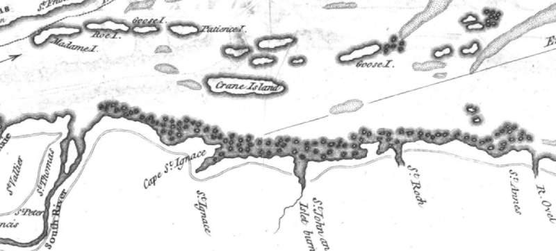
English: This is a detail from the source map, which is titled as follows: River St. Lawrence from Montréal to the Island of St. Barnaby... and the Island of Jeremy. This detail shows a portion of the Saint Lawrence River east of Quebec City, showing locations of note in the March 1776 Battle of Saint-Pierre: Crane Island (Île-aux-Grues), St. Anne's (St.-Anne-de-la-Pocatiere), St. Thomas, and St. Peter (Saint-Pierre).
Datum
Bron
Logo BAnQ
Deze afbeelding is afkomstig uit de Bibliothèque et Archives nationales du Québec onder referentienummer 0002663585

Deze banner zegt niets over de auteursrechten die van toepassing zijn. Een normale auteursrechten-tag is nodig. Zie Commons:Licensing voor meer informatie.
Boarisch | বাংলা | čeština | Deutsch | Zazaki | English | فارسی | suomi | français | हिन्दी | magyar | македонски | Nederlands | polski | português | русский | ไทย | Tiếng Việt | +/−
Flag of Quebec

URL at time of upload: http://services.banq.qc.ca/sdx/cep/document.xsp?app=ca.BAnQ.sdx.cep&db=notice&id=0002663585&n=9&dbrf0=xtgpleintexte_fr_FR&dbrv0=lawrence&sBtn=Lancer&qlang=fr-FR&db=notice&dbrn=1&sortfield=titre_trie&order=ascendant&col=america&chpp=20&dbrqp=search_notice&qid=sdx_q0
Auteur
Thomas Kitchin  (1718–1784)  wikidata:Q3688020
 
Aliassen
Thomas Kitchen
Beschrijving Brits cartograaf en prentkunstenaar
Geboorte- en sterfdatum 1718 23 juni 1784 Bewerk dit op Wikidata
Geboorte- en sterfplaats Southwark Bewerk dit op Wikidata Londen Bewerk dit op Wikidata
Bibliografische informatie
creator QS:P170,Q3688020

Licentie

Public domain

Dit werk bevindt zich in het publiek domein in landen en gebieden waar de auteursrechttermijn het leven van de auteur plus 100 jaar of minder is.


Je dient ook een Amerikaans publiek domein-tag in te voegen om aan te geven waarom dit werk zich in het publiek domein bevindt in de Verenigde Staten.
Van dit bestand is vastgesteld dat er geen bekende auteursrechtaanspraken op rusten, alle aanverwante en naburige rechten daarbij inbegrepen.

Bijschriften

Beschrijf in één regel wat dit bestand voorstelt

Items getoond in dit bestand

beeldt af

Bestandsgeschiedenis

Klik op een datum/tijd om het bestand te zien zoals het destijds was.

Datum/tijdMiniatuurAfmetingenGebruikerOpmerking
huidige versie13 feb 2009 03:24Miniatuurafbeelding voor de versie van 13 feb 2009 03:241.105 × 500 (450 kB)Magicpiano{{Information |Description={{en|1=This is a detail from the source map, which is titled as follows: River St. Lawrence from Montréal to the Island of St. Barnaby... and the Island of Jeremy. This detail shows a portion of the Saint Lawrence River east o

Dit bestand wordt op de volgende pagina gebruikt:

Globaal bestandsgebruik

De volgende andere wiki's gebruiken dit bestand: