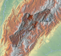
Bestand:Altiplano Cundiboyacense.png

Grootte van deze voorvertoning: 652 × 600 pixels. Andere resoluties: 261 × 240 pixels | 522 × 480 pixels | 835 × 768 pixels | 1.114 × 1.024 pixels | 1.740 × 1.600 pixels.
Oorspronkelijk bestand (1.740 × 1.600 pixels, bestandsgrootte: 6,59 MB, MIME-type: image/png)
Bestandsgeschiedenis
Klik op een datum/tijd om het bestand te zien zoals het destijds was.
| Datum/tijd | Miniatuur | Afmetingen | Gebruiker | Opmerking | |
|---|---|---|---|---|---|
| huidige versie | 6 apr 2013 21:32 |  | 1.740 × 1.600 (6,59 MB) | Dr Brains | User created page with UploadWizard |
Bestandsgebruik
Dit bestand wordt op de volgende 2 pagina's gebruikt:
Globaal bestandsgebruik
De volgende andere wiki's gebruiken dit bestand:
- Gebruikt op ca.wiki.x.io
- Gebruikt op ceb.wiki.x.io
- Gebruikt op en.wiki.x.io
- Muisca
- Bogotá River
- Altiplano Cundiboyacense
- Spanish conquest of New Granada
- El Abra
- Bogotá savanna
- Piedras del Tunjo Archaeological Park
- El Infiernito
- Thickhead ground snake
- Ubaté River
- Wetlands of Bogotá
- Muisca Confederation
- Herrera Period
- Tequendama
- Muisca architecture
- Lake Herrera
- Template:Timeline of inhabitation of the Altiplano Cundiboyacense
- Muisca mummification
- Tenza Valley
- List of flora and fauna named after the Muisca
- Lake Tauca
- Category:Altiplano Cundiboyacense
- Aguazuque
- Muisca art
- Tibitó
- Checua
- List of Muisca and pre-Muisca sites
- Luis Lanchero
- Ocetá Páramo
- Baltasar Maldonado
- Epítome de la conquista del Nuevo Reino de Granada
- Eastern Hills (Bogotá)
- Cabildo Mayor del Pueblo Muisca
- Module:Location map/data/Colombia Altiplano Cundiboyacense
- Module:Location map/data/Colombia Altiplano Cundiboyacense/doc
- Fucha River
- Tunjuelo River
- Soacha River
- Suárez River
- Arzobispo River
- Pedro Ruíz Corredor
- Teusacá River
- Template:Muisca navbox/geography and history
- Simijaca Formation
- Guaduas Formation
- Torca River
- Río Frío (Bogotá savanna)
- Conejo Formation
Globaal gebruik van dit bestand bekijken.
